Buoywatch

Highs, lows and the daily rhythm
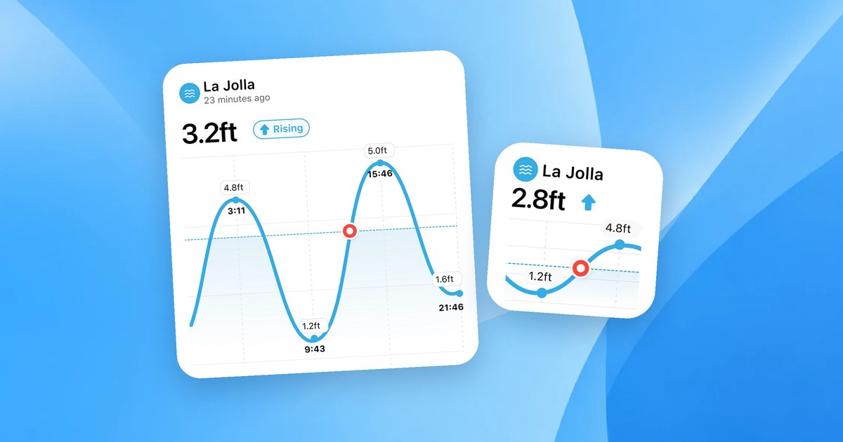
On most Atlantic and Pacific coasts the tide is semidiurnal: two high tides and two low tides each day. Because the Moon’s cycle is a little longer than a day, highs come about 50 minutes later each day. A tide chart lists those times and heights and draws the curve between them.
What the height means
Tide heights are measured from a reference level called a datum. In the United States, NOAA uses Mean Lower Low Water (MLLW), so zero is the average of each day’s lower low tide and negative values mean an unusually low tide; tide pages such as Honolulu and San Francisco (Golden Gate) use it. Some predictions, including those Buoywatch calculates from TICON-4 tidal constants, are relative to mean sea level, so lows show as negative numbers. Compare tides at one station using the same datum.
Reading the curve
The water does not rise at a steady rate. It moves slowly around high and low, and fastest in the middle of the rising or falling tide. A useful rule of thumb, the “rule of twelfths”, says that in the six hours between low and high the tide rises about 1/12 of its range in the first hour, 2/12 in the second, 3/12 in the third and fourth, then 2/12 and 1/12. That is why a session at mid-tide can change quickly.
| Tide stage | What changes |
|---|---|
| Low | Sandbanks and reefs are shallower; waves break harder or close out |
| Rising (incoming) | Water depth increases quickly at mid-tide |
| High | Deeper water; some beach breaks get soft or “fat” |
| Falling (outgoing) | Depth decreases; currents can strengthen near river mouths |
Spring and neap tides
The range between high and low changes over two weeks. Around new and full moon, spring tides have the biggest range; around quarter moons, neap tides have the smallest. A big spring range can make one stage of the tide much shorter or longer at your break. See Spring Tides and Neap Tides for Surfers.
Putting it together
Start with the buoy to see if there is swell, then open the nearest tide station to see when your break’s favourite stage arrives. On each Buoywatch buoy page, the tide card for the nearest station, such as Haleiwa, Waialua Bay for the Waimea Bay buoy, shows the current level, the next highs and lows, and today’s curve. In California, La Jolla (Scripps Institution Wharf) pairs with the Torrey Pines Outer buoy.